
![]() Map skills borrow concepts from many different disciplines, including Math, Art, Language and of course Geography. Map skills should be basic to student education early in their journey and then used often to measure distances, calculate routes, preview field trip locations, explore historic sites, and more.
Map skills borrow concepts from many different disciplines, including Math, Art, Language and of course Geography. Map skills should be basic to student education early in their journey and then used often to measure distances, calculate routes, preview field trip locations, explore historic sites, and more.
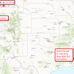
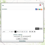
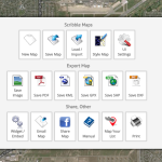
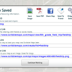
For many of you, I’m not saying anything you don’t already know — but have you tried to personalize a map? Draw a spotlight exactly where you want students to look, or sketch the route to a field trip? With most maps, it’s difficult, time-consuming, and non-intuitive, but Scribble Maps make all of these chores possible and more by letting you first, select the map best suited to your purpose (for example, a topographic one for a hike — under ESRI-Topography), and second, write directly onto the maps with a freehand drawing tool or by typing, add placemarks, draw shapes, calculate distance and area, and add image overlays. You can even add video and audio files. Maps can be saved as images, PDFs, or native files, and shared via email, blogs, a direct link, or embedded into online locations. It’s intuitive, easily learned by doing for students who hate reading directions, and is compatible with desktops, laptops, Chromebooks, iPads, and Android tablets. Because it uses Google Maps as its foundation, it will instantly feel familiar. Plus, it requires no log-in, so no email address for students.

Pros
The no-account-required feature is perfect for younger students who don’t have email accounts yet.
You can add a personalized legend to differentiate between colored routes or customized placemarks.
Once you’ve selected a location (say, where students are going on a field trip), you can add markers for nearby restaurants in seconds.
Cons
It does include sidebar advertising, which can be eliminated with a premium plan.
Maps must be saved as public files unless you have a premium account
Insider Tip
The Scribble Map page can be used as a whiteboard, taking advantage of all the Scribble Map tools for writing, drawing, adding images, and more.
14 ways to use them in the classroom
- find the setting locations for a story being read in class
- explore the geographic area around a historic event
- explore how geography affects history
- locate and describe landforms in a country, on a continent, or worldwide
- map a list — this extra feature is great for quickly mapping out historic locations, literary scenes, student home addresses, and more.
- personalize placemarks to country flags–great for K-2 units on Communities
- add descriptive details to a location using the placemark dialogue box
- for digital storytelling, use the placemark dialogue box to tell a story through the settings
- follow Lewis and Clarke’s search for the Northwest Passage
- track Odysseus’ odyssey through the Mediterranean Sea
- calculate the distance to a class field trip using the straight or flight line tool
- plot out an immigrant family’s journey from their homeland to their new home
- highlight favorite parts of a student’s neighborhood for a unit on Communities
- for special needs students: Map out community locations they visit on a daily or weekly basis
As maps grow in importance in your classroom, you won’t find an easier, more flexible, more scalable tool than Scribble Maps.
More on maps
Lesson Plan: Where Did I Come From?
Lesson Plan: Use Oregon Trail to Teach Westward Expansion
Jacqui Murray has been teaching K-18 technology for 30 years. She is the editor/author of over a hundred tech ed resources including a K-12 technology curriculum, K-8 keyboard curriculum, K-8 Digital Citizenship curriculum. She is an adjunct professor in tech ed, Master Teacher, webmaster for four blogs, an Amazon Vine Voice, CSTA presentation reviewer, freelance journalist on tech ed topics, contributor to NEA Today, and author of the tech thrillers, To Hunt a Sub and Twenty-four Days. You can find her resources at Structured Learning.


1 thought on “14 Ways to use Scribble Maps”
Comments are closed.